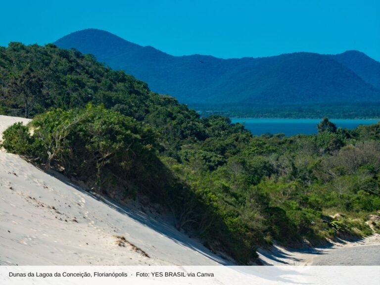
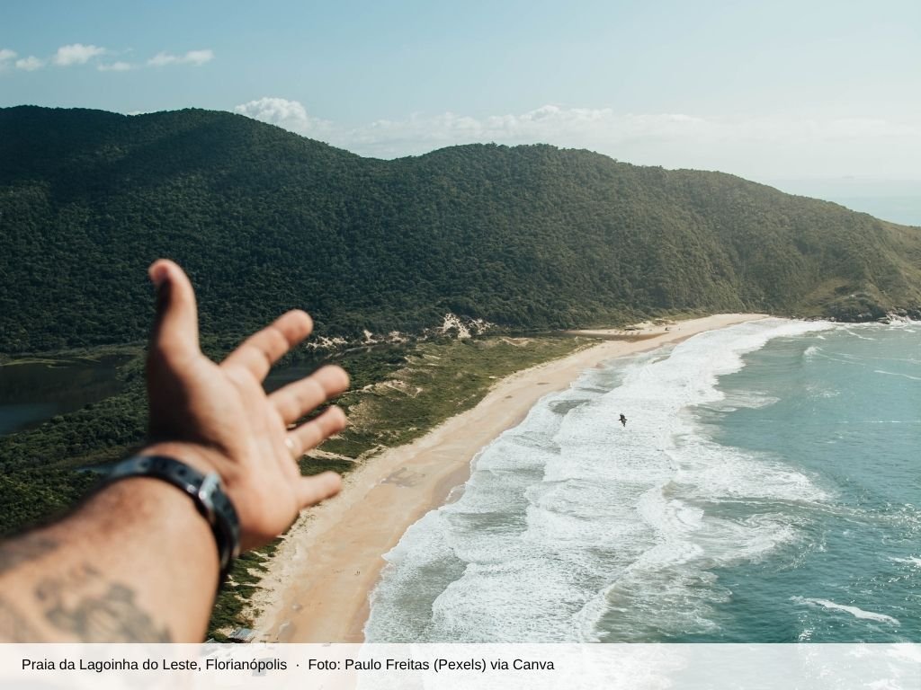
A Lagoinha do Leste Trail It leads to one of the most secluded beaches on Santa Catarina Island, with no buildings in sight and a freshwater lagoon right next to the ocean. There are two routes: the shorter one through Pântano do Sul, which is about 2.2 km and takes 1 hour and 30 minutes to walk, and the one through Armação, passing by Matadeiro Beach, which is about 4 km and takes 2 hours and 30 minutes to 3 hours.
The beach is located within a municipal park and has no facilities, so you’ll need to take everything you bring back with you. From downtown, the starting points are about 25 km away, in the southern part of the island. See below for tips on choosing a trail and preparing for the hike.
The Lagoinha do Leste Municipal Natural Park
The park was established in 1992 and incorporated into the national system of conservation areas in 2018. It covers approximately 920 hectares in the Pântano do Sul district, protecting Atlantic Forest, sandbank ecosystems, Morro da Coroa, the Sangradouro River, and Matadeiro Beach. It is managed by Floram, the municipal environmental foundation.
In January 2026, the city government published the park’s management plan. Most of the area was designated as a restricted zone, with no public access. The traditional trails remain open, but visitors should follow all signs and refrain from creating new paths.
The two trails
1. Through the Southern Swamp
This is the most popular trail. It begins at the top of Pântano do Sul, with an ascent of about 1.4 km through dense forest, followed by a descent of approximately 1 km to the beach. Recent guidebooks estimate the hike takes 1 hour and 30 minutes and is of moderate difficulty. The ascent is steep and has loose rocks.
A variation first goes up to the Morro da Coroa, about 1.2 km past the starting point, and descends about 800 m to the beach. The view from above takes in the lagoon and the entire stretch of sand. Many people walk this stretch at dawn to watch the sunrise.
2. Through Armação and Matadeiro Beach
It starts at Armação and continues for about 1.3 km to Matadeiro Beach. From there, it’s approximately 4 km along the coast to the northern tip of Lagoinha. It’s the most scenic route, with a view of the ocean almost the entire way, but also the most tiring, with sections of slippery rocks. Allow 2 hours and 30 minutes to 3 hours just for the one-way trip.
A common option is to go one way and return the other, but that requires combining different modes of transportation, because the starting points are in different neighborhoods.
Safety on the Trail
- Start early and plan your return trip so you'll leave the beach well before dark.
- Avoid the trail on rainy days or right after it rains: the rocks and mud get very slippery.
- Pedra do Surfista has been closed since January 2025 due to the risk of collapse. Please respect the closure.
- Do not climb onto rocks to take pictures, and do not go near the shoreline when the waves are rough.
- Before entering the lagoon, take a few minutes to look around: capybaras often show up there.
- Do not feed animals, including marmosets.
- Let someone know your itinerary and estimated return time. Cell phone service may be unreliable.
What to Bring
Bring plenty of water, snacks, sunscreen, a hat, insect repellent, and a trash bag, because there’s no trash collection on the beach. Wear hiking shoes or shoes with good traction. Drink vendors are only around during peak season, so don’t count on them. Camping isn’t officially permitted in the park, so plan to make a day trip.
How to get there from downtown
1. By bus
At TICEN, take the line 410 TIRIO/TICEN Direct (Platform B, Track 19) to the Rio Tavares Terminal. From there, the line 564 Pântano do Sul Take the SC-405 and SC-406 to the neighborhood. Route 564 has about 12 departures on weekdays, with long gaps in the middle of the day, so check the schedule on the Consórcio Fênix website. If you’re starting from Armação, there’s a TIRIO bus line that goes to the neighborhood.
2. By car or ride-hailing app
Take SC-405 to the Tavares River, then take SC-406 toward Armação or Pântano do Sul. There are private parking lots at the start of the trail through the Pântano. In January 2026, a guide recorded the trip by R$ 30 car.
Frequently Asked Questions
What is the easiest trail to Lagoinha do Leste?
The Pântano do Sul Trail: about 2.2 km and 1 hour and 30 minutes. Even so, it has some steep climbs, so it requires basic fitness.
Are there any restaurants or restrooms at Lagoinha do Leste?
No. The beach has no permanent facilities. Bring everything you need and take your trash back with you.
Can we go by boat?
During the summer, there is a boat service operated in partnership with local fishermen and coordinated by the park board. Please confirm that the service is operating at Pântano do Sul before counting on it.
Head back from the trail to the comforts of downtown
After a day of hiking, it's nice to have a convenient place to stay. The Hotel Farol da Ilha is located on Bento Gonçalves Street, near the downtown bus terminal, 450 m from the Public Market. See the accommodations at the Hotel Farol da Ilha and plan your trips around the island.
Cover photo: Paulo Freitas (Pexels) via Canva.